By Abdon M. Balde Jr.
TO THE SECRET CAVES OF THE MONSTERS
Having made sure that Libmanan was indeed the domain of Handiong, I decided to look for the places where the monsters must have come from or where they hide when pursued by Handiong and his warriors. It may seem illogical for many, even idiotic, to look for places that exist in folk tales and myths and legends, but I still believe what an old man in our barrio told me that myths and legends might be blurred memories of things past. So I pursued my almost impossible dream of finding Ibalong.
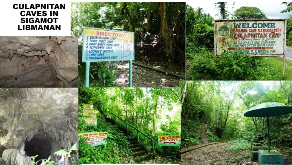
I have seen in the crude map on the wall of the municipal hall of Libmanan a place called Culapnitan Cave—which was in Sigamot, still part of Libmanan but near Sipocot. On consulting the old 1896 Bikol map which I purchased from Old Manila in Megamall, and always carried in the glove compartment of my van, I was surprised to see that the location of the Culapnitan Cave coincided with the location of the mountain range called “Amlig” or “Hantu” in the old map. Again, my intuition served me well. The 22nd stanza of the Ibalong narrative had this line: “Las serpientes, que tenian cual de serena la voz, del Hantic en la caverna…” A simple consultation with Google yield this translation: “The serpents, who had a serene voice, of the Hantic in the cave…” There were times during those years intuitions served me well, when I imagined things I have not seen before, when I felt I could not be wrong.

Thus, along the national highway, as I drove my van slowly towards Sipocot, we were on the alert for the place called Sigamot. As soon as we entered the Sigamot area I stopped on a small store and asked direction for the Culapnitan Cave. I was told to look on the left side of the highway for a signboard under a big tree. It was not long before we found the place! We had to get off the highway and enter a dirt road paved with uneven stones. There were thick vegetation on either side, bamboo grooves, narra, ipil-ipil and some talisay trees. It was nearing noon time, and not a soul was on the narrow ascending foot path, though we could see some huts under thick foliage of trees. After travelling over a kilometer, with no one on sight, I stopped the van in front of a signboard that read: DIRECTORY: Legend: Bankhouse, Lourdes Grotto, Cave Laya, Cave Kalangkawan, Cave Alingasay, Cave Balinsasayaw, Water System, Nature Trail. Further ahead, I saw another DIRECTORY: and under it was a list of 7 caves. The mouth of at least 2 caves were visible about a hundred meters away, but the shrubs and wild plants grew around and partly hide the came entrances. Fe would not let me go near, much less enter the caves without any guide. “There might be snakes in there,” she said, “you never know what you might encounter inside. Better just take pictures and we go.” And that was what I did—took pictures. We drove back to the national highway, and again I parked the van on the shoulders, went out and try to estimate the height of the hills where the caves were located.
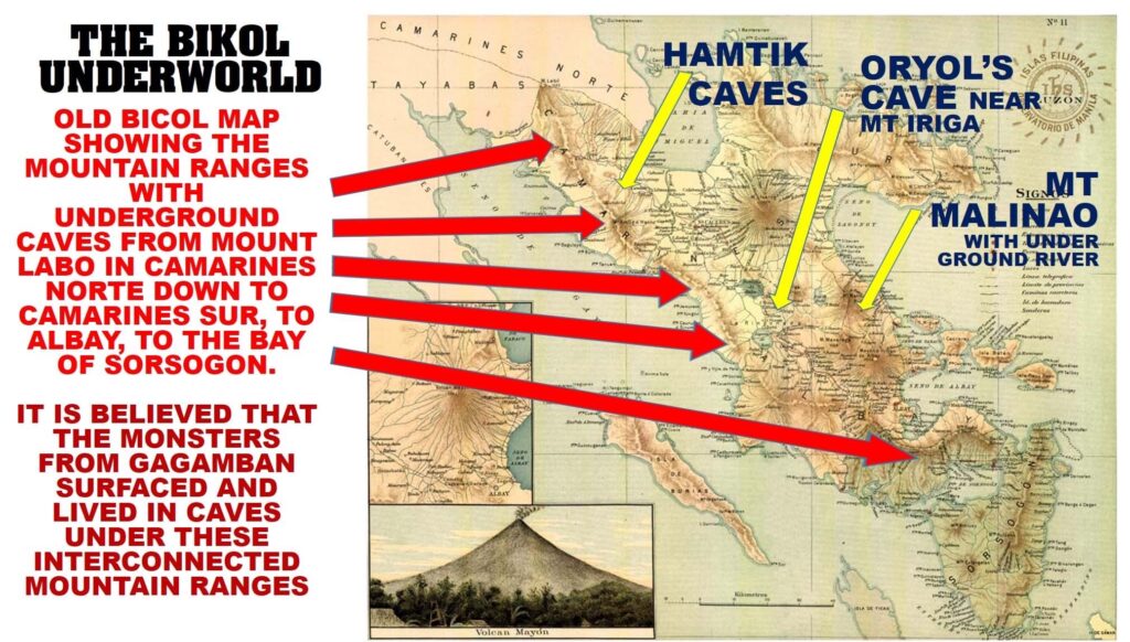
What I saw pleased me: I estimated that the mountain range in Libmanan was linked by a series of ranges to Mount Labo in the north and continued down south. I calculated correctly when I consulted my 1896 map: the mountain ranges went from Libmanan to Pasacao, ran on the sea edges of Ragay, down to Lake Bato, went to Pantao in Libon to the heights of Mount Cagongcongan, then down to Maoraro, Guinobatan, to Camalig, turned right to Kimantong in Daraga, went to Manito, to Prieto Diaz (Puerto Montufar in olden times) then went straight to Mount Bulusan in Sorsogon until it ended near Matnog—overlooking the Embocadero de San Bernardino.
The mountains of Isarog, Masaraga, Mayon and Malinao were far from this mountain range. Only Mount Iriga stood near! And it was the very reason why I pursued my hunch as to where the lair of Oryol could be found! A few months after I located the caves in ancient Hantic, I decide to look for the lair of Oryol—the serpent daughter of Aswang. I have studied hard the locations in the old map and was convinced that Oryol lived in a cave at the foot of Mount Iriga, in Camarines Sur. The reason? Oryol’s other name was Iraga—and I had it from some old people that the mountain, and even the city, was called Iraga in ancient times. It was enough encouragement for me.
On this trip, I encouraged my friend Daniel Pinto to come with me. From Las Pinas City I fetched Dan Pinto in Laguna and we went straight to the city hall of Iriga where the writer Frank Penones worked. I have arranged with Frank to get a mountaineer who would guide us as we look for a cave under Mount Iriga. Frank was at first reluctant because he did not know where to look for Oryol’s cave, but he went on to hire another writer/mountaineer named Andro Nacario. As soon as I heard his family name, I remembered the tale of the writer Jose Calleja Reyes that the old man he met near Agos River—who could chant some lines in the Ibalong narrative—was a Nacario! I kept it to myself but I already had a premonition that I was on the right path.

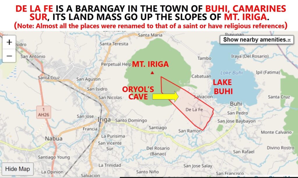
From the Iriga City hall, we travelled towards Mount Iriga and asked for directions as to where there might be a cave at the foot of the mountain. As fate have it, we did not find the cave in Iriga City—we found it in Buhi, the nearby town in a place called De la Fe. A coconut farmer who made charcoal guided us to the cave. It was a shallow cave, very much silted already, but enough for me to speculate that maybe in ancient times Oryol lived there. It was very close to Lake Buhi—which, according to the narrative of Ibalong was formed when half of Mount Iriga collapsed during the simultaneous eruption of volcanoes. On one side of Lake Buhi were the huge stones of the collapsed mountain—aptly called Cabatuan; on the other bank of the lake stood Mount Malinao—which already belonged to the Province of Albay.


